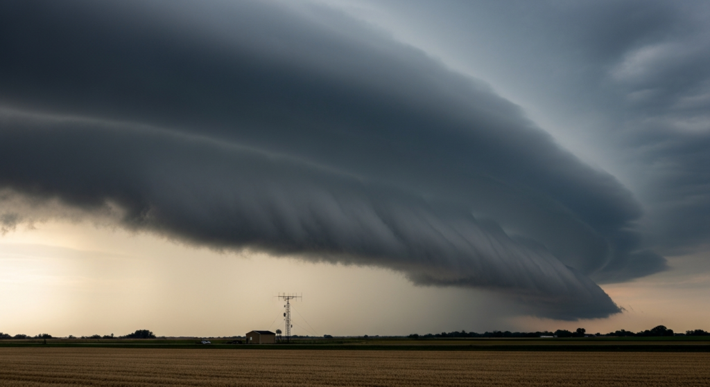
Outdoor plans across parts of the northern Plains and Upper Midwest face potential disruption on Sunday due to the risk of severe thunderstorms. Independent weather-risk assessments have flagged significant thunderstorm potential for the region.
The primary hazards identified in these non-federal summaries are large hail and damaging winds. While tornadoes are a possibility, the risk is currently assessed as lower compared to the likelihood of hail and wind events. Residents and event organizers in the affected areas are advised to monitor updated forecasts.
This forecast underscores the dynamic nature of summer weather patterns, which can impact outdoor activities and travel. Local authorities and event planners often use such outlooks to prepare for potential disruptions and ensure public safety measures are in place. The information serves as a precursor for local entities to provide more specific guidance based on verified regional forecasts and planned events.
While the immediate focus of this severe weather outlook is on the northern Plains and Upper Midwest, the broader implications highlight the importance of staying informed about weather conditions, especially during seasons prone to significant atmospheric activity. The potential for severe weather serves as a reminder for individuals and communities to have contingency plans for outdoor events and travel.
For those in the affected regions, preparedness can involve securing outdoor items, having a plan for seeking shelter, and staying updated on the latest weather advisories. The timing of these storms could impact various outdoor activities, from local gatherings to longer-distance travel through the affected zones. The meteorological conditions conducive to these storms are typical for this time of year in those specific geographic areas.
The severity of thunderstorms can vary, with the potential for rapid development and significant localized impacts. The combination of atmospheric instability and moisture provides the fuel for these potent storm systems. Meteorologists will be closely tracking the evolution of these systems throughout the weekend.
This outlook is based on current modeling and observational data, and forecasts can change. Continuous monitoring of weather updates is recommended for those with outdoor plans in the northern Plains and Upper Midwest. The focus remains on the potential for large hail and damaging straight-line winds as the most significant threats.